The Norwegian original is shown where a reviewed translation is unavailable. Names and source information remain in their original language.
Movika
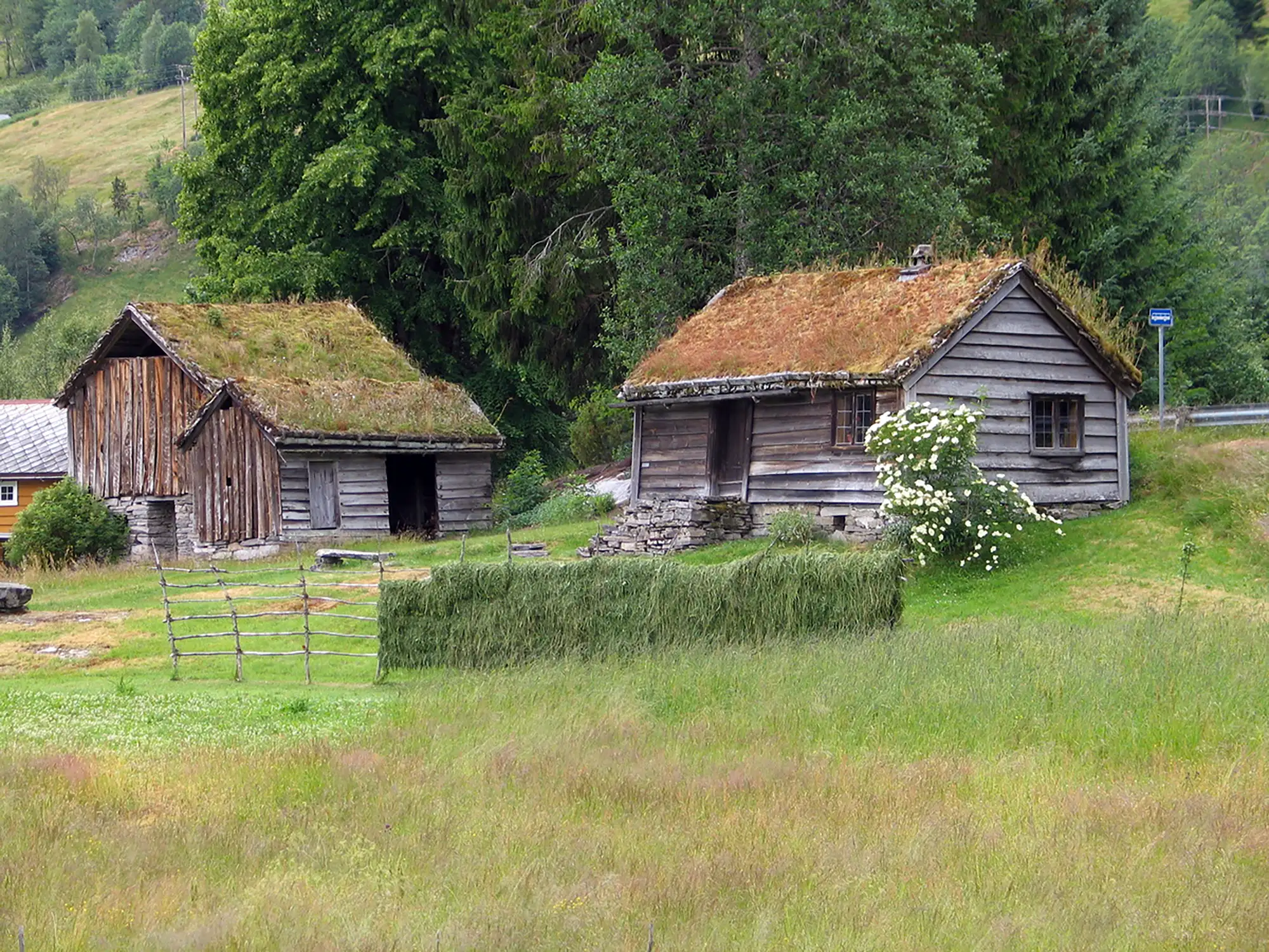
Forsidebilde. Det blir lagt inn kreditering til fotograf på forsiden, med link til plass-siden.
Førde · Sunnfjord · Vestland

Fakta om plassen
- Site type
- Croft with land
- The place today
- Preserved building
- Fylke og kommune
- Vestland, Sunnfjord
Lives, work and belonging
The people who lived here
Open a name to read about the person, their work and family. Life dates and connections to the place are shown separately.
No resident information published yet
We have not yet published information about who lived here. Documentation may grow as further sources are examined.
See people connected to this place →
The place through time
The history of this place
Forsidebilde. Det blir lagt inn kreditering til fotograf på forsiden, med link til plass-siden. Begrunnelsen for å bruke bildet som forsidebilde er at husene representerer en reell husmannsplass. Flere av bygningene er opprinnelige og står på selve plassen. Det gamle miljøet eksisterer sammen med dagens vei, busstopp og annen moderne infrastruktur. Jordbrukslandskapet foran husene er ikke bare kulisse, men deler av den gamle husmannsplassens innmark.
The place in its landscape
Map and surroundings
The map loads when you reach this part of the page.
- The place today
- Preserved building
- Coordinate accuracy
- Precise
Behind the story
Sources and facts
No separate source records for this place have been published yet.
Sources for person details, work and family relationships are shown in each person's profile.
All place details and register references
Identitet og grunninformasjon
- ID-kode
- HMP-NO-000009
Geografi og kart
- Koordinatpresisjon
- Precise
Administrativ tilknytning
- Nåværende kommune
- Sunnfjord
- Nåværende fylke
- Vestland
- Område / kulturhistorisk region
- Førde
Type, status og tidsperiode
- Plasstype
- Croft with land
- Fysisk status
- Preserved building
Beboere og personer
- Status of documentation about people
- Assessment not recorded
Visits and interpretation
- Visitor site
- No
Public coordinates
DMS: 61° 26′ 22.06″ N, 5° 58′ 25.57″ E
WGS84: 61.439460, 5.973770
UTM 33N (ETRS89): N 6845071, E 19654
This printout includes the current page of the resident list and profiles that have been opened. It is not a complete export of the person register or family tree.